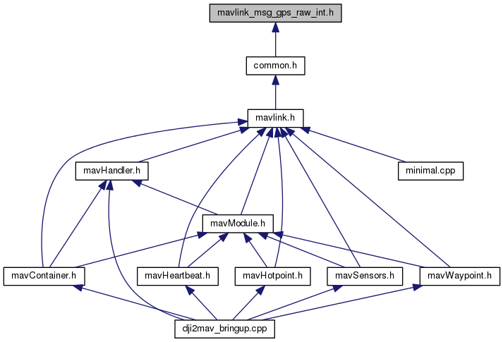
Go to the source code of this file.
Classes | |
| struct | __mavlink_gps_raw_int_t |
Defines | |
| #define | MAVLINK_MESSAGE_INFO_GPS_RAW_INT |
| #define | MAVLINK_MSG_ID_24_CRC 24 |
| #define | MAVLINK_MSG_ID_24_LEN 30 |
| #define | MAVLINK_MSG_ID_GPS_RAW_INT 24 |
| #define | MAVLINK_MSG_ID_GPS_RAW_INT_CRC 24 |
| #define | MAVLINK_MSG_ID_GPS_RAW_INT_LEN 30 |
Typedefs | |
| typedef struct __mavlink_gps_raw_int_t | mavlink_gps_raw_int_t |
Functions | |
| static void | mavlink_msg_gps_raw_int_decode (const mavlink_message_t *msg, mavlink_gps_raw_int_t *gps_raw_int) |
| Decode a gps_raw_int message into a struct. | |
| static uint16_t | mavlink_msg_gps_raw_int_encode (uint8_t system_id, uint8_t component_id, mavlink_message_t *msg, const mavlink_gps_raw_int_t *gps_raw_int) |
| Encode a gps_raw_int struct. | |
| static uint16_t | mavlink_msg_gps_raw_int_encode_chan (uint8_t system_id, uint8_t component_id, uint8_t chan, mavlink_message_t *msg, const mavlink_gps_raw_int_t *gps_raw_int) |
| Encode a gps_raw_int struct on a channel. | |
| static int32_t | mavlink_msg_gps_raw_int_get_alt (const mavlink_message_t *msg) |
| Get field alt from gps_raw_int message. | |
| static uint16_t | mavlink_msg_gps_raw_int_get_cog (const mavlink_message_t *msg) |
| Get field cog from gps_raw_int message. | |
| static uint16_t | mavlink_msg_gps_raw_int_get_eph (const mavlink_message_t *msg) |
| Get field eph from gps_raw_int message. | |
| static uint16_t | mavlink_msg_gps_raw_int_get_epv (const mavlink_message_t *msg) |
| Get field epv from gps_raw_int message. | |
| static uint8_t | mavlink_msg_gps_raw_int_get_fix_type (const mavlink_message_t *msg) |
| Get field fix_type from gps_raw_int message. | |
| static int32_t | mavlink_msg_gps_raw_int_get_lat (const mavlink_message_t *msg) |
| Get field lat from gps_raw_int message. | |
| static int32_t | mavlink_msg_gps_raw_int_get_lon (const mavlink_message_t *msg) |
| Get field lon from gps_raw_int message. | |
| static uint8_t | mavlink_msg_gps_raw_int_get_satellites_visible (const mavlink_message_t *msg) |
| Get field satellites_visible from gps_raw_int message. | |
| static uint64_t | mavlink_msg_gps_raw_int_get_time_usec (const mavlink_message_t *msg) |
| Send a gps_raw_int message. | |
| static uint16_t | mavlink_msg_gps_raw_int_get_vel (const mavlink_message_t *msg) |
| Get field vel from gps_raw_int message. | |
| static uint16_t | mavlink_msg_gps_raw_int_pack (uint8_t system_id, uint8_t component_id, mavlink_message_t *msg, uint64_t time_usec, uint8_t fix_type, int32_t lat, int32_t lon, int32_t alt, uint16_t eph, uint16_t epv, uint16_t vel, uint16_t cog, uint8_t satellites_visible) |
| Pack a gps_raw_int message. | |
| static uint16_t | mavlink_msg_gps_raw_int_pack_chan (uint8_t system_id, uint8_t component_id, uint8_t chan, mavlink_message_t *msg, uint64_t time_usec, uint8_t fix_type, int32_t lat, int32_t lon, int32_t alt, uint16_t eph, uint16_t epv, uint16_t vel, uint16_t cog, uint8_t satellites_visible) |
| Pack a gps_raw_int message on a channel. | |
Define Documentation
| #define MAVLINK_MESSAGE_INFO_GPS_RAW_INT |
{ \
        "GPS_RAW_INT", \
        10, \
        {  { "time_usec", NULL, MAVLINK_TYPE_UINT64_T, 0, 0, offsetof(mavlink_gps_raw_int_t, time_usec) }, \
         { "lat", NULL, MAVLINK_TYPE_INT32_T, 0, 8, offsetof(mavlink_gps_raw_int_t, lat) }, \
         { "lon", NULL, MAVLINK_TYPE_INT32_T, 0, 12, offsetof(mavlink_gps_raw_int_t, lon) }, \
         { "alt", NULL, MAVLINK_TYPE_INT32_T, 0, 16, offsetof(mavlink_gps_raw_int_t, alt) }, \
         { "eph", NULL, MAVLINK_TYPE_UINT16_T, 0, 20, offsetof(mavlink_gps_raw_int_t, eph) }, \
         { "epv", NULL, MAVLINK_TYPE_UINT16_T, 0, 22, offsetof(mavlink_gps_raw_int_t, epv) }, \
         { "vel", NULL, MAVLINK_TYPE_UINT16_T, 0, 24, offsetof(mavlink_gps_raw_int_t, vel) }, \
         { "cog", NULL, MAVLINK_TYPE_UINT16_T, 0, 26, offsetof(mavlink_gps_raw_int_t, cog) }, \
         { "fix_type", NULL, MAVLINK_TYPE_UINT8_T, 0, 28, offsetof(mavlink_gps_raw_int_t, fix_type) }, \
         { "satellites_visible", NULL, MAVLINK_TYPE_UINT8_T, 0, 29, offsetof(mavlink_gps_raw_int_t, satellites_visible) }, \
         } \
}
Definition at line 27 of file mavlink_msg_gps_raw_int.h.
| #define MAVLINK_MSG_ID_24_CRC 24 |
Definition at line 23 of file mavlink_msg_gps_raw_int.h.
| #define MAVLINK_MSG_ID_24_LEN 30 |
Definition at line 20 of file mavlink_msg_gps_raw_int.h.
| #define MAVLINK_MSG_ID_GPS_RAW_INT 24 |
Definition at line 3 of file mavlink_msg_gps_raw_int.h.
| #define MAVLINK_MSG_ID_GPS_RAW_INT_CRC 24 |
Definition at line 22 of file mavlink_msg_gps_raw_int.h.
| #define MAVLINK_MSG_ID_GPS_RAW_INT_LEN 30 |
Definition at line 19 of file mavlink_msg_gps_raw_int.h.
Typedef Documentation
| typedef struct __mavlink_gps_raw_int_t mavlink_gps_raw_int_t |
Function Documentation
| static void mavlink_msg_gps_raw_int_decode | ( | const mavlink_message_t * | msg, |
| mavlink_gps_raw_int_t * | gps_raw_int | ||
| ) | [inline, static] |
Decode a gps_raw_int message into a struct.
- Parameters:
-
msg The message to decode gps_raw_int C-struct to decode the message contents into
Definition at line 409 of file mavlink_msg_gps_raw_int.h.
| static uint16_t mavlink_msg_gps_raw_int_encode | ( | uint8_t | system_id, |
| uint8_t | component_id, | ||
| mavlink_message_t * | msg, | ||
| const mavlink_gps_raw_int_t * | gps_raw_int | ||
| ) | [inline, static] |
Encode a gps_raw_int struct.
- Parameters:
-
system_id ID of this system component_id ID of this component (e.g. 200 for IMU) msg The MAVLink message to compress the data into gps_raw_int C-struct to read the message contents from
Definition at line 171 of file mavlink_msg_gps_raw_int.h.
| static uint16_t mavlink_msg_gps_raw_int_encode_chan | ( | uint8_t | system_id, |
| uint8_t | component_id, | ||
| uint8_t | chan, | ||
| mavlink_message_t * | msg, | ||
| const mavlink_gps_raw_int_t * | gps_raw_int | ||
| ) | [inline, static] |
Encode a gps_raw_int struct on a channel.
- Parameters:
-
system_id ID of this system component_id ID of this component (e.g. 200 for IMU) chan The MAVLink channel this message will be sent over msg The MAVLink message to compress the data into gps_raw_int C-struct to read the message contents from
Definition at line 185 of file mavlink_msg_gps_raw_int.h.
| static int32_t mavlink_msg_gps_raw_int_get_alt | ( | const mavlink_message_t * | msg | ) | [inline, static] |
Get field alt from gps_raw_int message.
- Returns:
- Altitude (AMSL, NOT WGS84), in meters * 1000 (positive for up). Note that virtually all GPS modules provide the AMSL altitude in addition to the WGS84 altitude.
Definition at line 348 of file mavlink_msg_gps_raw_int.h.
| static uint16_t mavlink_msg_gps_raw_int_get_cog | ( | const mavlink_message_t * | msg | ) | [inline, static] |
Get field cog from gps_raw_int message.
- Returns:
- Course over ground (NOT heading, but direction of movement) in degrees * 100, 0.0..359.99 degrees. If unknown, set to: UINT16_MAX
Definition at line 388 of file mavlink_msg_gps_raw_int.h.
| static uint16_t mavlink_msg_gps_raw_int_get_eph | ( | const mavlink_message_t * | msg | ) | [inline, static] |
Get field eph from gps_raw_int message.
- Returns:
- GPS HDOP horizontal dilution of position in cm (m*100). If unknown, set to: UINT16_MAX
Definition at line 358 of file mavlink_msg_gps_raw_int.h.
| static uint16_t mavlink_msg_gps_raw_int_get_epv | ( | const mavlink_message_t * | msg | ) | [inline, static] |
Get field epv from gps_raw_int message.
- Returns:
- GPS VDOP vertical dilution of position in cm (m*100). If unknown, set to: UINT16_MAX
Definition at line 368 of file mavlink_msg_gps_raw_int.h.
| static uint8_t mavlink_msg_gps_raw_int_get_fix_type | ( | const mavlink_message_t * | msg | ) | [inline, static] |
Get field fix_type from gps_raw_int message.
- Returns:
- 0-1: no fix, 2: 2D fix, 3: 3D fix, 4: DGPS, 5: RTK. Some applications will not use the value of this field unless it is at least two, so always correctly fill in the fix.
Definition at line 318 of file mavlink_msg_gps_raw_int.h.
| static int32_t mavlink_msg_gps_raw_int_get_lat | ( | const mavlink_message_t * | msg | ) | [inline, static] |
Get field lat from gps_raw_int message.
- Returns:
- Latitude (WGS84), in degrees * 1E7
Definition at line 328 of file mavlink_msg_gps_raw_int.h.
| static int32_t mavlink_msg_gps_raw_int_get_lon | ( | const mavlink_message_t * | msg | ) | [inline, static] |
Get field lon from gps_raw_int message.
- Returns:
- Longitude (WGS84), in degrees * 1E7
Definition at line 338 of file mavlink_msg_gps_raw_int.h.
| static uint8_t mavlink_msg_gps_raw_int_get_satellites_visible | ( | const mavlink_message_t * | msg | ) | [inline, static] |
Get field satellites_visible from gps_raw_int message.
- Returns:
- Number of satellites visible. If unknown, set to 255
Definition at line 398 of file mavlink_msg_gps_raw_int.h.
| static uint64_t mavlink_msg_gps_raw_int_get_time_usec | ( | const mavlink_message_t * | msg | ) | [inline, static] |
Send a gps_raw_int message.
- Parameters:
-
chan MAVLink channel to send the message time_usec Timestamp (microseconds since UNIX epoch or microseconds since system boot) fix_type 0-1: no fix, 2: 2D fix, 3: 3D fix, 4: DGPS, 5: RTK. Some applications will not use the value of this field unless it is at least two, so always correctly fill in the fix. lat Latitude (WGS84), in degrees * 1E7 lon Longitude (WGS84), in degrees * 1E7 alt Altitude (AMSL, NOT WGS84), in meters * 1000 (positive for up). Note that virtually all GPS modules provide the AMSL altitude in addition to the WGS84 altitude. eph GPS HDOP horizontal dilution of position in cm (m*100). If unknown, set to: UINT16_MAX epv GPS VDOP vertical dilution of position in cm (m*100). If unknown, set to: UINT16_MAX vel GPS ground speed (m/s * 100). If unknown, set to: UINT16_MAX cog Course over ground (NOT heading, but direction of movement) in degrees * 100, 0.0..359.99 degrees. If unknown, set to: UINT16_MAX satellites_visible Number of satellites visible. If unknown, set to 255 Get field time_usec from gps_raw_int message
- Returns:
- Timestamp (microseconds since UNIX epoch or microseconds since system boot)
Definition at line 308 of file mavlink_msg_gps_raw_int.h.
| static uint16_t mavlink_msg_gps_raw_int_get_vel | ( | const mavlink_message_t * | msg | ) | [inline, static] |
Get field vel from gps_raw_int message.
- Returns:
- GPS ground speed (m/s * 100). If unknown, set to: UINT16_MAX
Definition at line 378 of file mavlink_msg_gps_raw_int.h.
| static uint16_t mavlink_msg_gps_raw_int_pack | ( | uint8_t | system_id, |
| uint8_t | component_id, | ||
| mavlink_message_t * | msg, | ||
| uint64_t | time_usec, | ||
| uint8_t | fix_type, | ||
| int32_t | lat, | ||
| int32_t | lon, | ||
| int32_t | alt, | ||
| uint16_t | eph, | ||
| uint16_t | epv, | ||
| uint16_t | vel, | ||
| uint16_t | cog, | ||
| uint8_t | satellites_visible | ||
| ) | [inline, static] |
Pack a gps_raw_int message.
- Parameters:
-
system_id ID of this system component_id ID of this component (e.g. 200 for IMU) msg The MAVLink message to compress the data into time_usec Timestamp (microseconds since UNIX epoch or microseconds since system boot) fix_type 0-1: no fix, 2: 2D fix, 3: 3D fix, 4: DGPS, 5: RTK. Some applications will not use the value of this field unless it is at least two, so always correctly fill in the fix. lat Latitude (WGS84), in degrees * 1E7 lon Longitude (WGS84), in degrees * 1E7 alt Altitude (AMSL, NOT WGS84), in meters * 1000 (positive for up). Note that virtually all GPS modules provide the AMSL altitude in addition to the WGS84 altitude. eph GPS HDOP horizontal dilution of position in cm (m*100). If unknown, set to: UINT16_MAX epv GPS VDOP vertical dilution of position in cm (m*100). If unknown, set to: UINT16_MAX vel GPS ground speed (m/s * 100). If unknown, set to: UINT16_MAX cog Course over ground (NOT heading, but direction of movement) in degrees * 100, 0.0..359.99 degrees. If unknown, set to: UINT16_MAX satellites_visible Number of satellites visible. If unknown, set to 255
- Returns:
- length of the message in bytes (excluding serial stream start sign)
Definition at line 62 of file mavlink_msg_gps_raw_int.h.
| static uint16_t mavlink_msg_gps_raw_int_pack_chan | ( | uint8_t | system_id, |
| uint8_t | component_id, | ||
| uint8_t | chan, | ||
| mavlink_message_t * | msg, | ||
| uint64_t | time_usec, | ||
| uint8_t | fix_type, | ||
| int32_t | lat, | ||
| int32_t | lon, | ||
| int32_t | alt, | ||
| uint16_t | eph, | ||
| uint16_t | epv, | ||
| uint16_t | vel, | ||
| uint16_t | cog, | ||
| uint8_t | satellites_visible | ||
| ) | [inline, static] |
Pack a gps_raw_int message on a channel.
- Parameters:
-
system_id ID of this system component_id ID of this component (e.g. 200 for IMU) chan The MAVLink channel this message will be sent over msg The MAVLink message to compress the data into time_usec Timestamp (microseconds since UNIX epoch or microseconds since system boot) fix_type 0-1: no fix, 2: 2D fix, 3: 3D fix, 4: DGPS, 5: RTK. Some applications will not use the value of this field unless it is at least two, so always correctly fill in the fix. lat Latitude (WGS84), in degrees * 1E7 lon Longitude (WGS84), in degrees * 1E7 alt Altitude (AMSL, NOT WGS84), in meters * 1000 (positive for up). Note that virtually all GPS modules provide the AMSL altitude in addition to the WGS84 altitude. eph GPS HDOP horizontal dilution of position in cm (m*100). If unknown, set to: UINT16_MAX epv GPS VDOP vertical dilution of position in cm (m*100). If unknown, set to: UINT16_MAX vel GPS ground speed (m/s * 100). If unknown, set to: UINT16_MAX cog Course over ground (NOT heading, but direction of movement) in degrees * 100, 0.0..359.99 degrees. If unknown, set to: UINT16_MAX satellites_visible Number of satellites visible. If unknown, set to 255
- Returns:
- length of the message in bytes (excluding serial stream start sign)
Definition at line 121 of file mavlink_msg_gps_raw_int.h.