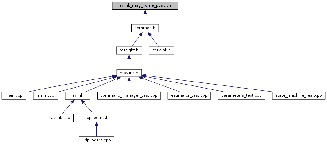
Go to the source code of this file.
Classes | |
| struct | __mavlink_home_position_t |
Macros | |
| #define | MAVLINK_MESSAGE_INFO_HOME_POSITION |
| #define | MAVLINK_MSG_HOME_POSITION_FIELD_Q_LEN 4 |
| #define | MAVLINK_MSG_ID_242_CRC 104 |
| #define | MAVLINK_MSG_ID_242_LEN 52 |
| #define | MAVLINK_MSG_ID_HOME_POSITION 242 |
| #define | MAVLINK_MSG_ID_HOME_POSITION_CRC 104 |
| #define | MAVLINK_MSG_ID_HOME_POSITION_LEN 52 |
Typedefs | |
| typedef struct __mavlink_home_position_t | mavlink_home_position_t |
Functions | |
| static void | mavlink_msg_home_position_decode (const mavlink_message_t *msg, mavlink_home_position_t *home_position) |
| Decode a home_position message into a struct. More... | |
| static uint16_t | mavlink_msg_home_position_encode (uint8_t system_id, uint8_t component_id, mavlink_message_t *msg, const mavlink_home_position_t *home_position) |
| Encode a home_position struct. More... | |
| static uint16_t | mavlink_msg_home_position_encode_chan (uint8_t system_id, uint8_t component_id, uint8_t chan, mavlink_message_t *msg, const mavlink_home_position_t *home_position) |
| Encode a home_position struct on a channel. More... | |
| static int32_t | mavlink_msg_home_position_get_altitude (const mavlink_message_t *msg) |
| Get field altitude from home_position message. More... | |
| static float | mavlink_msg_home_position_get_approach_x (const mavlink_message_t *msg) |
| Get field approach_x from home_position message. More... | |
| static float | mavlink_msg_home_position_get_approach_y (const mavlink_message_t *msg) |
| Get field approach_y from home_position message. More... | |
| static float | mavlink_msg_home_position_get_approach_z (const mavlink_message_t *msg) |
| Get field approach_z from home_position message. More... | |
| static int32_t | mavlink_msg_home_position_get_latitude (const mavlink_message_t *msg) |
| Send a home_position message. More... | |
| static int32_t | mavlink_msg_home_position_get_longitude (const mavlink_message_t *msg) |
| Get field longitude from home_position message. More... | |
| static uint16_t | mavlink_msg_home_position_get_q (const mavlink_message_t *msg, float *q) |
| Get field q from home_position message. More... | |
| static float | mavlink_msg_home_position_get_x (const mavlink_message_t *msg) |
| Get field x from home_position message. More... | |
| static float | mavlink_msg_home_position_get_y (const mavlink_message_t *msg) |
| Get field y from home_position message. More... | |
| static float | mavlink_msg_home_position_get_z (const mavlink_message_t *msg) |
| Get field z from home_position message. More... | |
| static uint16_t | mavlink_msg_home_position_pack (uint8_t system_id, uint8_t component_id, mavlink_message_t *msg, int32_t latitude, int32_t longitude, int32_t altitude, float x, float y, float z, const float *q, float approach_x, float approach_y, float approach_z) |
| Pack a home_position message. More... | |
| static uint16_t | mavlink_msg_home_position_pack_chan (uint8_t system_id, uint8_t component_id, uint8_t chan, mavlink_message_t *msg, int32_t latitude, int32_t longitude, int32_t altitude, float x, float y, float z, const float *q, float approach_x, float approach_y, float approach_z) |
| Pack a home_position message on a channel. More... | |
Macro Definition Documentation
| #define MAVLINK_MESSAGE_INFO_HOME_POSITION |
Definition at line 27 of file mavlink_msg_home_position.h.
| #define MAVLINK_MSG_HOME_POSITION_FIELD_Q_LEN 4 |
Definition at line 25 of file mavlink_msg_home_position.h.
| #define MAVLINK_MSG_ID_242_CRC 104 |
Definition at line 23 of file mavlink_msg_home_position.h.
| #define MAVLINK_MSG_ID_242_LEN 52 |
Definition at line 20 of file mavlink_msg_home_position.h.
| #define MAVLINK_MSG_ID_HOME_POSITION 242 |
Definition at line 3 of file mavlink_msg_home_position.h.
| #define MAVLINK_MSG_ID_HOME_POSITION_CRC 104 |
Definition at line 22 of file mavlink_msg_home_position.h.
| #define MAVLINK_MSG_ID_HOME_POSITION_LEN 52 |
Definition at line 19 of file mavlink_msg_home_position.h.
Typedef Documentation
| typedef struct __mavlink_home_position_t mavlink_home_position_t |
Function Documentation
|
inlinestatic |
Decode a home_position message into a struct.
- Parameters
-
msg The message to decode home_position C-struct to decode the message contents into
Definition at line 401 of file mavlink_msg_home_position.h.
|
inlinestatic |
Encode a home_position struct.
- Parameters
-
system_id ID of this system component_id ID of this component (e.g. 200 for IMU) msg The MAVLink message to compress the data into home_position C-struct to read the message contents from
Definition at line 167 of file mavlink_msg_home_position.h.
|
inlinestatic |
Encode a home_position struct on a channel.
- Parameters
-
system_id ID of this system component_id ID of this component (e.g. 200 for IMU) chan The MAVLink channel this message will be sent over msg The MAVLink message to compress the data into home_position C-struct to read the message contents from
Definition at line 181 of file mavlink_msg_home_position.h.
|
inlinestatic |
Get field altitude from home_position message.
- Returns
- Altitude (AMSL), in meters * 1000 (positive for up)
Definition at line 320 of file mavlink_msg_home_position.h.
|
inlinestatic |
Get field approach_x from home_position message.
- Returns
- Local X position of the end of the approach vector. Multicopters should set this position based on their takeoff path. Grass-landing fixed wing aircraft should set it the same way as multicopters. Runway-landing fixed wing aircraft should set it to the opposite direction of the takeoff, assuming the takeoff happened from the threshold / touchdown zone.
Definition at line 370 of file mavlink_msg_home_position.h.
|
inlinestatic |
Get field approach_y from home_position message.
- Returns
- Local Y position of the end of the approach vector. Multicopters should set this position based on their takeoff path. Grass-landing fixed wing aircraft should set it the same way as multicopters. Runway-landing fixed wing aircraft should set it to the opposite direction of the takeoff, assuming the takeoff happened from the threshold / touchdown zone.
Definition at line 380 of file mavlink_msg_home_position.h.
|
inlinestatic |
Get field approach_z from home_position message.
- Returns
- Local Z position of the end of the approach vector. Multicopters should set this position based on their takeoff path. Grass-landing fixed wing aircraft should set it the same way as multicopters. Runway-landing fixed wing aircraft should set it to the opposite direction of the takeoff, assuming the takeoff happened from the threshold / touchdown zone.
Definition at line 390 of file mavlink_msg_home_position.h.
|
inlinestatic |
Send a home_position message.
- Parameters
-
chan MAVLink channel to send the message latitude Latitude (WGS84), in degrees * 1E7 longitude Longitude (WGS84, in degrees * 1E7 altitude Altitude (AMSL), in meters * 1000 (positive for up) x Local X position of this position in the local coordinate frame y Local Y position of this position in the local coordinate frame z Local Z position of this position in the local coordinate frame q World to surface normal and heading transformation of the takeoff position. Used to indicate the heading and slope of the ground approach_x Local X position of the end of the approach vector. Multicopters should set this position based on their takeoff path. Grass-landing fixed wing aircraft should set it the same way as multicopters. Runway-landing fixed wing aircraft should set it to the opposite direction of the takeoff, assuming the takeoff happened from the threshold / touchdown zone. approach_y Local Y position of the end of the approach vector. Multicopters should set this position based on their takeoff path. Grass-landing fixed wing aircraft should set it the same way as multicopters. Runway-landing fixed wing aircraft should set it to the opposite direction of the takeoff, assuming the takeoff happened from the threshold / touchdown zone. approach_z Local Z position of the end of the approach vector. Multicopters should set this position based on their takeoff path. Grass-landing fixed wing aircraft should set it the same way as multicopters. Runway-landing fixed wing aircraft should set it to the opposite direction of the takeoff, assuming the takeoff happened from the threshold / touchdown zone. Get field latitude from home_position message
- Returns
- Latitude (WGS84), in degrees * 1E7
Definition at line 300 of file mavlink_msg_home_position.h.
|
inlinestatic |
Get field longitude from home_position message.
- Returns
- Longitude (WGS84, in degrees * 1E7
Definition at line 310 of file mavlink_msg_home_position.h.
|
inlinestatic |
Get field q from home_position message.
- Returns
- World to surface normal and heading transformation of the takeoff position. Used to indicate the heading and slope of the ground
Definition at line 360 of file mavlink_msg_home_position.h.
|
inlinestatic |
Get field x from home_position message.
- Returns
- Local X position of this position in the local coordinate frame
Definition at line 330 of file mavlink_msg_home_position.h.
|
inlinestatic |
Get field y from home_position message.
- Returns
- Local Y position of this position in the local coordinate frame
Definition at line 340 of file mavlink_msg_home_position.h.
|
inlinestatic |
Get field z from home_position message.
- Returns
- Local Z position of this position in the local coordinate frame
Definition at line 350 of file mavlink_msg_home_position.h.
|
inlinestatic |
Pack a home_position message.
- Parameters
-
system_id ID of this system component_id ID of this component (e.g. 200 for IMU) msg The MAVLink message to compress the data into latitude Latitude (WGS84), in degrees * 1E7 longitude Longitude (WGS84, in degrees * 1E7 altitude Altitude (AMSL), in meters * 1000 (positive for up) x Local X position of this position in the local coordinate frame y Local Y position of this position in the local coordinate frame z Local Z position of this position in the local coordinate frame q World to surface normal and heading transformation of the takeoff position. Used to indicate the heading and slope of the ground approach_x Local X position of the end of the approach vector. Multicopters should set this position based on their takeoff path. Grass-landing fixed wing aircraft should set it the same way as multicopters. Runway-landing fixed wing aircraft should set it to the opposite direction of the takeoff, assuming the takeoff happened from the threshold / touchdown zone. approach_y Local Y position of the end of the approach vector. Multicopters should set this position based on their takeoff path. Grass-landing fixed wing aircraft should set it the same way as multicopters. Runway-landing fixed wing aircraft should set it to the opposite direction of the takeoff, assuming the takeoff happened from the threshold / touchdown zone. approach_z Local Z position of the end of the approach vector. Multicopters should set this position based on their takeoff path. Grass-landing fixed wing aircraft should set it the same way as multicopters. Runway-landing fixed wing aircraft should set it to the opposite direction of the takeoff, assuming the takeoff happened from the threshold / touchdown zone.
- Returns
- length of the message in bytes (excluding serial stream start sign)
Definition at line 62 of file mavlink_msg_home_position.h.
|
inlinestatic |
Pack a home_position message on a channel.
- Parameters
-
system_id ID of this system component_id ID of this component (e.g. 200 for IMU) chan The MAVLink channel this message will be sent over msg The MAVLink message to compress the data into latitude Latitude (WGS84), in degrees * 1E7 longitude Longitude (WGS84, in degrees * 1E7 altitude Altitude (AMSL), in meters * 1000 (positive for up) x Local X position of this position in the local coordinate frame y Local Y position of this position in the local coordinate frame z Local Z position of this position in the local coordinate frame q World to surface normal and heading transformation of the takeoff position. Used to indicate the heading and slope of the ground approach_x Local X position of the end of the approach vector. Multicopters should set this position based on their takeoff path. Grass-landing fixed wing aircraft should set it the same way as multicopters. Runway-landing fixed wing aircraft should set it to the opposite direction of the takeoff, assuming the takeoff happened from the threshold / touchdown zone. approach_y Local Y position of the end of the approach vector. Multicopters should set this position based on their takeoff path. Grass-landing fixed wing aircraft should set it the same way as multicopters. Runway-landing fixed wing aircraft should set it to the opposite direction of the takeoff, assuming the takeoff happened from the threshold / touchdown zone. approach_z Local Z position of the end of the approach vector. Multicopters should set this position based on their takeoff path. Grass-landing fixed wing aircraft should set it the same way as multicopters. Runway-landing fixed wing aircraft should set it to the opposite direction of the takeoff, assuming the takeoff happened from the threshold / touchdown zone.
- Returns
- length of the message in bytes (excluding serial stream start sign)
Definition at line 119 of file mavlink_msg_home_position.h.